|
Catalog | Order | Support | Index | Contact | Home | ||||||||||
|
|
|
|
|
|
|
|||||||||||
| USA Relief | Tech Spec | Catalog | Guide | Download | License | |||||||||||


USA Relief Catalog - The State of South Carolina
Map Specifications for the State of South Carolina
| Map identification: | South Carolina | Projection system: | Geographic / Plate Carree |
| Map coverage: | State of South Carolina | North boundary: | 36� North |
| Image size (pixels): | 7200 x 4800 pixels | South boundary: | 32� North |
| Map size at 300 dpi: | 24 x 16 inches | East boundary: | 78� West |
| Map size at 100 dpi: | 96 x 64 inches | West boundary: | 84� West |
| Resolution per pixel: | 100 meters | Scale (300 dpi): | 1:1,000,000 |
| RGB file size: | 104 Mb | Scale (72 dpi): | 1:400,000 |
| CMYK file size: | 138 Mb | Vertical interval: | 100 meters |
| Grayscale file size: | 35 Mb | Vertical exaggeration: | 3 times normal |
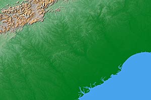 Cartographic style relief rendering Check out the detail view |
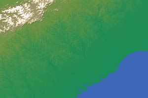 Designer house style relief rendering |
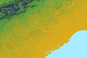 High contrast elevation style relief rendering |
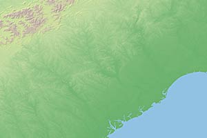 Low contrast elevation style relief rendering |
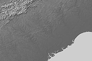 Grayscale land relief rendering |
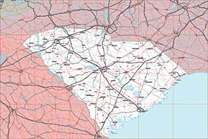 Vector EPS South Carolina map with layers Check out the detail view |
South Carolina Map #941 - Buying Options
|
State of South Carolina State of South Carolina |
Vector only EPS map of South Carolina available for download - $9 Compressed Download File: Win 9 MB - Mac 13 MB Relief & EPS Map Package of South Carolina available for download - $19 Compressed Download File: Win 77 MB - Mac 107 MB |
AK
AL
AR
AZ
CA
CO
CT
DE
FL
GA
HI
IA
ID
IL
IN
KS
KY
LA
MA
MD
ME
MI
MN
MO
MS
MT
NC
ND
NE
NH
NJ
NM
NV
NY
OH
OK
OR
PA
RI
SC
SD
TN
TX-E
TX-W
UT
VA
VT
WA
WI
WV
WY
![]()
USA Relief Maps ~ Digital Wisdom Inc ~ PO Box 11 ~ Tappahannock VA 22560 ~ USA
800-800-8560 | 804-443-9000 | Email
© Digital Wisdom, Inc.
Any comments or problems with this site? Please let us know - thank you!